![]()
![]()
![]()
![]()
![]()
![]()
![]()
![]()
![]()
![]()
![]()
![]()
![]()
![]() IDEAS
IDEAS
![]() Homes for Vacation & Long-Term
Rentals
Homes for Vacation & Long-Term
Rentals
![]()
|
Made With |
|
|
|
|
Dr. Hoffer's Travel Site This site was last updated 03/03/11 |
![]()
![]()
![]()
![]()
![]()
![]()
![]()
![]()
![]()
![]()
![]()
![]()
![]()
![]() IDEAS
IDEAS
![]() Homes for Vacation & Long-Term
Rentals
Homes for Vacation & Long-Term
Rentals
![]()
|
Made With |
|
|
|

![]() FRAN2005 #32 Vercors &
Chamb�ry
FRAN2005 #32 Vercors &
Chamb�ry ![]()
![]()
![]()
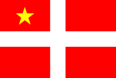
Flag of Grenoble
Wednesday July 20, 2005
Today is my oldest granddaughter, Kaylin's 5th Birthday. I am so sad to miss being with her for it. It is coincidental that it is also the day that Neil Armstrong landed on the moon in 1969 and the birthdays of my friend Dimitrii's oldest daughter, Daria and my good friend John Eales in Monterey.
I woke up at 7:15 with gum pain in the area of the bad tooth. I got up and brushed it to see if it would get it to calm down. It did a little and I was able to fall back to sleep. I then woke again at 11:00 and got out of bed. I'm really worried this tooth won't last the trip.
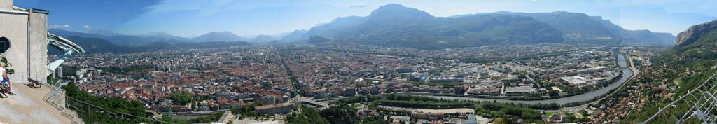
By 2:20 I went out for my run again but took different streets then I did yesterday. The art sculptures and buildings were all very nice and the city had a "clean" air about it.
.JPG)
.JPG)
.jpg)
I came across the church of Sacre Coeur [3 place Doyen Gosse] (lower right.) This photo of the marble plaque in front of the church became a self-portrait.
.JPG)
.JPG)
I went past many interesting buildings and monuments and finally came across a large park, place Victor Hugo, with several fountains and statues.
.JPG)
.JPG)
.JPG)
.JPG)
The problem in France is that it is difficult to interpret who the statues are in honor of. The one below left looks like Teddy Roosevelt.
.JPG)
.JPG)
.JPG)
They had these plastic blow-up booths surrounding this one fountain. They were pushing various products. As I was leaving I noticed they sell churros even here in France.
.JPG)
.JPG)
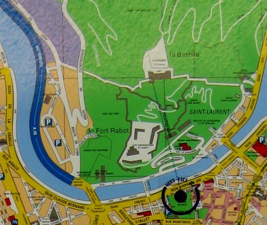
I finished my run at 3:10 back at the Caf� Stendahl and had a great cappuccino this time and called Marcia to join me. When done, at 3:40, we walked back to the hotel and I changed into street clothes in the garage. We discussed whether we should take the T�l�ph�rique and Marcia seemed to want to do it. I was surprised because she really hates heights. So we walked through the Jardins de Ville and arrived at the T�l�ph�rique station at quai St�phane-Jay along side the river. You can see that the length of the ride is 2,247 ft (685 m), the maximum elevation is 863 ft (263 m) and the speed up the hill is 20 ft/sec (6 m/sec) or about 14 mph (22 kph.)
.JPG)
.JPG)
All of a sudden, I was getting severe second thoughts about getting on this thing. It got worse as Marcia purchased the round trip tickets for two and we had to wait for the next one to arrive. If I could have jumped on the one that was leaving now, I would have been OK.
.JPG)
.JPG)
We didn't have to wait all that long, but the tension was building up and at 4:00 we boarded the first glass ball of the T�l�ph�rique, so that I could get great photos. From the map below, you can see the station (black circle) and the dotted line which is the path up the hill to the 19th Century Fort de la Bastille.
.JPG)
Here is how they look as they are taking off from the station and crossing the street and the Is�re River. I kept hoping it was being held by more than one wire and there were serious backups if it should break.
.JPG)
.JPG)
As I said, Marcia and I were sitting in the very first bubble. As we started to climb in to the stratosphere, I began to really get effected by this and could only get my mind off where I was by furiously switching back and forth between taking snapshots with the Canon and taking video with the SONY. That helped. Marcia was as calm as a cucumber. The photo lower right is a stock photo of the T�l�ph�rique in the winter time, the rest are mine.
.JPG)
.JPG)
Now we go over the river - just spectacular.
.JPG)
.JPG)
Now we are really heading up the hill and Marcia looks completely relaxed.
.JPG)
.JPG)
.JPG)
Now we are approaching the top and can see the the other one heading down.
.JPG)
.JPG)
This is the view map-style of what we were looking out on. You can see the confluence of the Drac and Is�re rivers in the upper left. The T�l�ph�rique station is the circle.
Here are the panoramic shots put together with PhotoStitch.
.jpg)
.jpg)
.jpg)
.jpg)
.jpg)
.JPG)
At 4:15 we walked around looking at the great views. Though she didn't mind the ride up, she didn't like being up there. We went into the tourist shop and I bought a pin while Marcia bought some postcards. I was really dreading getting back in that glass ball again to take it back down. I asked the clerk if there was any other way to get back down and he said I could take a taxi. I shuddered and asked where I could call one. He told me to try the restaurant nearby. Marcia was very happy to take it back down and we did have roundtrip tickets but I decided I did not want to ride in it again.
.JPG)
.JPG)
At 4:30 the restaurant called for a taxi and we waited for it on the patio of the restaurant. At 4:45 the taxi arrived and drove us down the winding road back into the city and dropped us off at the Ibis Hotel. The cabby's name was Fr�d�ric and he recommended a good restaurant in the city of Lyon, where he is from.
 We went into the hotel and at
5:00 we checked out and then got the car out
We went into the hotel and at
5:00 we checked out and then got the car out
 of the garage. We are
ultimately heading north to the city of Annecy but first I wanted to go through
both the
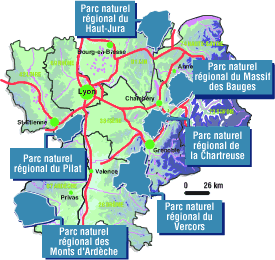
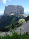
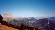
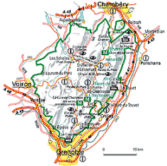
Chartreuse and the Vercors Mountains (map right) recommended in the guide books.
The Vercors are a little south and west of Grenoble so to see them we must make
a circle loop west. The region is the
Parc Naturale Regional du
Vercors (map left.) The Bourne River
runs through it and this was a key base for the French resistance. The Germans
launched an air attack here in 1944 and flattened several villages.
of the garage. We are
ultimately heading north to the city of Annecy but first I wanted to go through
both the
Chartreuse and the Vercors Mountains (map right) recommended in the guide books.
The Vercors are a little south and west of Grenoble so to see them we must make
a circle loop west. The region is the
Parc Naturale Regional du
Vercors (map left.) The Bourne River
runs through it and this was a key base for the French resistance. The Germans
launched an air attack here in 1944 and flattened several villages.
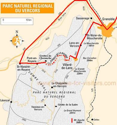
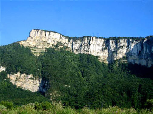
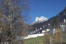
We drove west out of Grenoble (upper right of map) and headed south (red line) on the D531 through St-Nizier-du-Moucherotte named after the 6,234 ft (1900 m) Le Moucherotte mountain to the south. At 6:10 we were heading south for the dark Gorges de la Bourne.
.JPG)
.JPG)
.JPG)
.JPG)
After getting through the large mountains, we first reached the little town of Villard-de-Lans-en-Vercors (above map) situated on a plain. We were now in the "country."
.JPG)
.JPG)
This was proven when we had to stop and let a herd of cows cross the road.
.JPG)
.JPG)
We then continued west to start through the Gorges de la Bourne (map.)
.JPG)
.JPG)
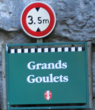
We continued on the tortuous roads until we entered the Grands Goulets (or Grand Gorges). We had no idea what a harrowing experience this would be. The skinny road is cut into the walls of the gorge with many tunnels.
.JPG)
.JPG)
.JPG)
.JPG)
.JPG)
.JPG)
.JPG)
.JPG)
.JPG)
.JPG)
.JPG)
.JPG)
.JPG)
At 6:30 we made a pit stop in the little town of St-Martin-en-Vercors and went inside this little tourist shop and bought some postcards and a Diet coke.
.JPG)
It was hard to believe that this was a two-lane road and that trucks were allowed. I t was broad daylight but some areas were so dark, the photos barely came out.
.JPG)
.JPG)
.JPG)
.JPG)
.JPG)
.JPG)
.JPG)
.JPG)
.JPG)
.JPG)
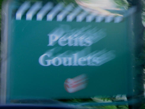
We then entered the Petits Goulets (Little Gorges) which were similar but not quite as exotic a drive as the previous one. Neither one of us have ever driven through anything remotely similar to this route. I don't know whether this slew of photographs can capture the depth of the experience. As is evident by the photo below left, it was very difficult getting shots during this whirlwind ride but some were surprisingly clear.
.JPG)
After you survive through one 180 degree turn, you have to swerve in the other direction and then go through a series of short tunnels.
.JPG)
.JPG)
After getting out of the gorges, we got back onto the plains and drove past huge mountains.
.JPG)
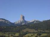
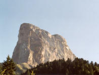
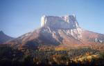
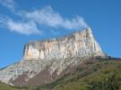
We didn't get to see the largest and most famous of them to the south, Mount Aiguille which is 6,844 ft (2,086 m) high, so here are some stock photos of it.
By 7:00 we arrived in the town of Pont-en-Royans (meaning the bridge across the Royans River). Here they have houses hewn out of a wall of stone. I wasn't able to get any photos.
 We took the D512 north toward Chamb�ry into the Chartreuse Mountains which are north of Grenoble.
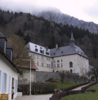
It was here that hydroelectricity was
first invented in the late 19th Century. In these mountains, the
Monost�re de la Grand Chartreuse
(monastery) was founded by St-Bruno in
1084. The monastery was built, burnt and rebuilt again seven times and
what is here today was built in the 1700s. These Carthusian monks invented their sticky green and yellow Chartreuse liqueurs in 1605.
It is made from 130 different ingredients and is now produced in the town of Voiron. Today,
forty Carthusian
monks are left living in silence and seclusion.
We took the D512 north toward Chamb�ry into the Chartreuse Mountains which are north of Grenoble.
It was here that hydroelectricity was
first invented in the late 19th Century. In these mountains, the
Monost�re de la Grand Chartreuse
(monastery) was founded by St-Bruno in
1084. The monastery was built, burnt and rebuilt again seven times and
what is here today was built in the 1700s. These Carthusian monks invented their sticky green and yellow Chartreuse liqueurs in 1605.
It is made from 130 different ingredients and is now produced in the town of Voiron. Today,
forty Carthusian
monks are left living in silence and seclusion.
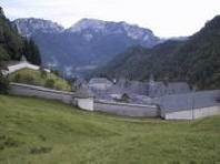
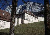
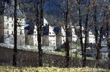
 Since it was getting late, we
could not
stop and thus we missed the monastery (5 stock photos above) and the nearby
Since it was getting late, we
could not
stop and thus we missed the monastery (5 stock photos above) and the nearby
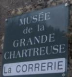
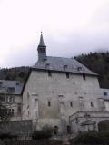 Mus�e de la Correrie
(stock photos above & below right)
[St-Pierre-de-Chartreuse,
Mus�e de la Correrie
(stock photos above & below right)
[St-Pierre-de-Chartreuse,
![]() +33-(0)4-7688-6045, open Apr-Oct, daily]. We were driving through the
Parc Naturale Regional de la Chartreuse. It was now getting to be late
and we felt we really didn't have time for touring anymore, so we skipped the
Cartreuse sipping and headed straight through the mountains north to our next
destinations of Chamb�ry and Annecy.
+33-(0)4-7688-6045, open Apr-Oct, daily]. We were driving through the
Parc Naturale Regional de la Chartreuse. It was now getting to be late
and we felt we really didn't have time for touring anymore, so we skipped the
Cartreuse sipping and headed straight through the mountains north to our next
destinations of Chamb�ry and Annecy.
.JPG)
.JPG)
By
7:15 we were on the A43 expressway heading north to Chamb�ry and Marcia drove the 66 miles
to get there. As you can see, if we made a right here would would be
heading to Italy and Torino and Milano. We decided we had better have dinner in Chamb�ry because
it would
be too late by the time we got to Annecy. Besides, we decided to stay two
days in Annecy and thus would be able to go to a restaurant there as well.
[Flag of Chamb�ry]
 Chamb�ry (pop 57,000) was once the capital of the
Savoy and because of this it has a
distinct Italian feel. To view a gallery of beautiful photos of Savoy,
click the flag. The capital of Savoy shifted to Torino (Turin)
Chamb�ry (pop 57,000) was once the capital of the
Savoy and because of this it has a
distinct Italian feel. To view a gallery of beautiful photos of Savoy,
click the flag. The capital of Savoy shifted to Torino (Turin)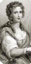 in the 16th Century. The line of Am�d�e counts oversaw the development
here. On the southeast edge of town is the famous
in the 16th Century. The line of Am�d�e counts oversaw the development
here. On the southeast edge of town is the famous
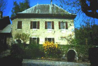
 Les Charmettes
(lower right) [892 chemin des Charmettes
Les Charmettes
(lower right) [892 chemin des Charmettes
![]() +33-(0)4-7933-3944, Wed-Mon].
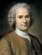
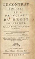
Jean-Jacques Rousseau,
(1712-78) the Romantic philosopher (who wrote the
The Social
Contract in 1762), lived
here with his mistress, Madame
Fran�oise-Louise de Warens (1699-1762) (left) from 1732-42. His
writings influenced the likes of
Maximilien Robespierre, the brutal architect of the
Reign of Terror and
Karl Marx,
the inventor of communism. If you are unaware of him, click the
links.
+33-(0)4-7933-3944, Wed-Mon].
Jean-Jacques Rousseau,
(1712-78) the Romantic philosopher (who wrote the
The Social
Contract in 1762), lived
here with his mistress, Madame
Fran�oise-Louise de Warens (1699-1762) (left) from 1732-42. His
writings influenced the likes of
Maximilien Robespierre, the brutal architect of the
Reign of Terror and
Karl Marx,
the inventor of communism. If you are unaware of him, click the
links.
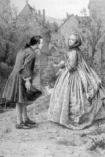
 He was born in Geneva and his mother died a few weeks after childbirth and his
father abandoned him at the age of six. He was raised as a Calvinist but
after falling madly in love with the older Madame de Warens he converted to
Catholicism (left). After teaching music in Annecy and staying with her
for ten years at Les Charmettes (above right,) he left her and went to London to
study with the great Scottish
He was born in Geneva and his mother died a few weeks after childbirth and his
father abandoned him at the age of six. He was raised as a Calvinist but
after falling madly in love with the older Madame de Warens he converted to
Catholicism (left). After teaching music in Annecy and staying with her
for ten years at Les Charmettes (above right,) he left her and went to London to
study with the great Scottish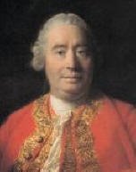 philosopher, David Hume
(photo right) (1711-76.)
philosopher, David Hume
(photo right) (1711-76.)
After a falling out with Hume, he went to Paris and lived with Th�r�se Lavasseur
an illiterate seamstress, and with her, he had five children, each of which he
put in an orphanage as soon as they were weaned - a real nut case in my opinion.
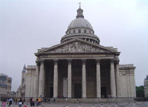
One of his writings (�mile, 1762, of all things, a treatise on how to
educate children) caused him to be exiled from France and Switzerland but in his
later years he was able to return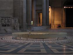 to Paris where he died and was buried
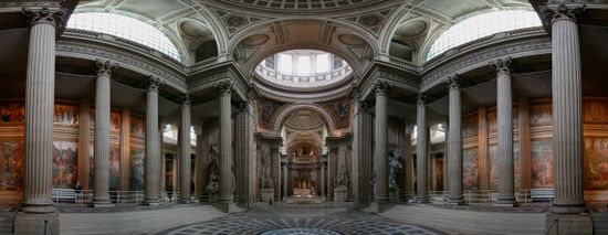
in the Panth�on
(below) next to the likes of
Voltaire,
Marat,
Victor
Hugo,
�mile Zola,
Marie Curie,
Louis
Braille and
Alexandre Dumas. In 1851
physicist
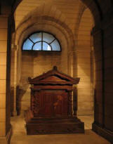
L�on
Foucault demonstrated the rotation of the Earth by his experiment conducted
in the Panth�on, by constructing a 67 meter
Foucault pendulum beneath the central dome (right.) The original iron
sphere from the pendulum was returned to the Panth�on in 1995.
to Paris where he died and was buried
in the Panth�on
(below) next to the likes of
Voltaire,
Marat,
Victor
Hugo,
�mile Zola,
Marie Curie,
Louis
Braille and
Alexandre Dumas. In 1851
physicist
L�on
Foucault demonstrated the rotation of the Earth by his experiment conducted
in the Panth�on, by constructing a 67 meter
Foucault pendulum beneath the central dome (right.) The original iron
sphere from the pendulum was returned to the Panth�on in 1995.
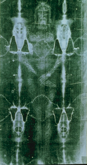
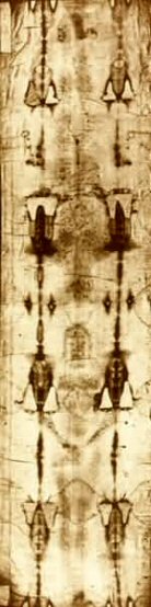
Shroud Positive Photo Shroud Negative Photo
 Though this was Wednesday,
it was much too late to go and see it so we drove to the center of town and
looked for restaurants. We found a place to park the car and then walked around
looking for the perfect place to eat. From the map you can see the Sainte
Chapelle (Royal Chapel of Chamb�ry Castle) church
we saw and it was closed (below right.) This is where the
Shroud of Turin was held after it was
brought from the Holy Land in 1453. In 1502, the Shroud was given a
permanent home here. In 1532, a fire broke out in the chapel and the
Shroud was seriously damaged by molten silver that fell on one corner of the
folded cloth. This resulted in eight roughly symmetrical burn patterns and
two burn lines running the length of the cloth. So this is where the fire
burns occurred, wow. In April 1534, Chamb�ry's
Poor Clare nuns repaired the Shroud by
sewing it onto a backing cloth and sewing patches over the worst of the damage.
The Shroud was moved to Turin in 1578, so its not in there anyway and we didn't
miss anything.
Though this was Wednesday,
it was much too late to go and see it so we drove to the center of town and
looked for restaurants. We found a place to park the car and then walked around
looking for the perfect place to eat. From the map you can see the Sainte
Chapelle (Royal Chapel of Chamb�ry Castle) church
we saw and it was closed (below right.) This is where the
Shroud of Turin was held after it was
brought from the Holy Land in 1453. In 1502, the Shroud was given a
permanent home here. In 1532, a fire broke out in the chapel and the
Shroud was seriously damaged by molten silver that fell on one corner of the
folded cloth. This resulted in eight roughly symmetrical burn patterns and
two burn lines running the length of the cloth. So this is where the fire
burns occurred, wow. In April 1534, Chamb�ry's
Poor Clare nuns repaired the Shroud by
sewing it onto a backing cloth and sewing patches over the worst of the damage.
The Shroud was moved to Turin in 1578, so its not in there anyway and we didn't
miss anything.
.JPG)
.JPG)
We walked down the double orange Boulevard de la Collone (green line) and came across the central square with their famous fountain monument with four elephants coming out.
.JPG)
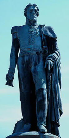
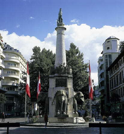
It was built in the 1830s in honor of Count Beno�t de Boigne (1751-1830) (his statue at the top wearing the uniform of the Kingdom of Sardinia), a local who made his fortunes in India and funded many city developments.
.JPG)
.JPG)
.JPG)
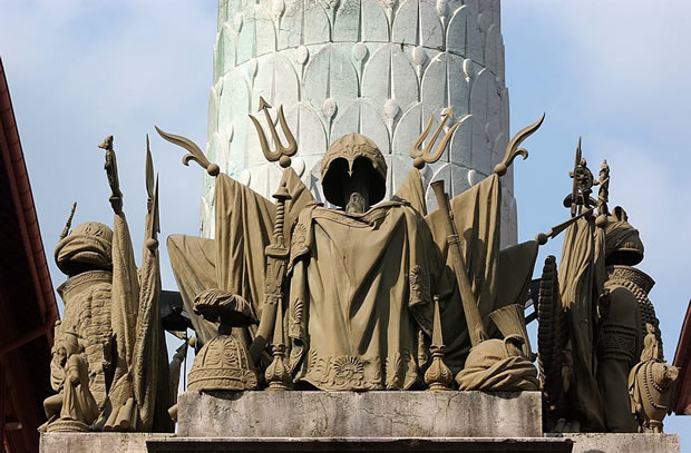
These items below are on the monument. The left is of his negotiations.
 The
right shows the Indian uniform he wore as commander-in-chief of the Hindu army
of leader Mahadji Sindhia
(1727-94) (photo right.) When the latter died, De Boigne could have become
the new ruler of Hindustan
but he resigned his command and returned to France where he was much revered.
If you read the links you will see that this Savoyard had a great effect on the
history of India.
The
right shows the Indian uniform he wore as commander-in-chief of the Hindu army
of leader Mahadji Sindhia
(1727-94) (photo right.) When the latter died, De Boigne could have become
the new ruler of Hindustan
but he resigned his command and returned to France where he was much revered.
If you read the links you will see that this Savoyard had a great effect on the
history of India.
.JPG)
.JPG)
Not finding the absolute perfect
place to eat, at
8:50 we decided to have dinner at
Auberge La Bessannaise [28 Place
Monge,
![]() +33-(0)4-79-33-4037] which was a cute little restaurant in the Hotel of the same name.
We got a table in the patio.
+33-(0)4-79-33-4037] which was a cute little restaurant in the Hotel of the same name.
We got a table in the patio.
.JPG)
.JPG)
") I went inside to the bathroom and on the way back I discovered their nice little
bar and ordered a Karlsbrau. Marcia and I then ordered a bottle of of
Marastel Vin de Savoie wine, since we were in Savoy and a bottle of San Pellegrino.
Then we looked at the menu.
I went inside to the bathroom and on the way back I discovered their nice little
bar and ordered a Karlsbrau. Marcia and I then ordered a bottle of of
Marastel Vin de Savoie wine, since we were in Savoy and a bottle of San Pellegrino.
Then we looked at the menu.
.JPG)
.JPG)
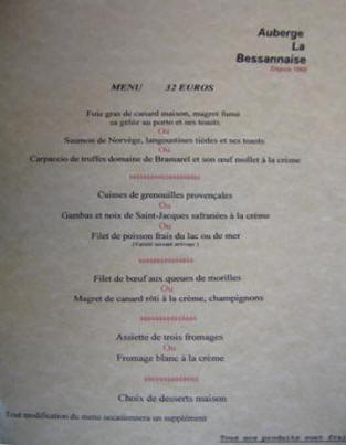
Marcia ordered her favorite chevre cheese salade and I decided to finally go ahead with the ubiquitous (foie gras) and ordered salade perigord consisting of foie gras di canard (duck pate) with duck fume (smoked.) We enjoyed them both. The pate was like butter.
.JPG)
.JPG)
For a main course I had (below left) magret de canard r�ti a la cr�me champignons (roast duck breast with cream and morel mushrooms), lyonnaise potatoes and sweet carrots while Marcia had perch (fish) with mushroom rice (below right.) They were both very good.
.JPG)
.JPG)
Marcia had cr�me br�l�e (pronounced krehm broo-LAY) for dessert and I had a few bites. It was fabulous.
.JPG)
It was getting late, so after eating, we walked back past the main pedestrian area (below right) and got back to the car.
.JPG)
.JPG)
Here are a few stock photos of the major buildings in the city since we had no time to explore the town: 1 - Rue Juverie, 2 - Palaise de Justice, 3 - H�tel de Ville (City Hall), 4 - Chamb�ry Theatre, and 5 - Chateaux de Chamb�ry.
1  2
2  3
3  4
4 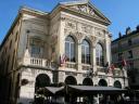 5
5 
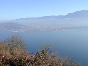
Near here is the very beautiful Lac d'Aiguebellette.
On the map below, to
the east of Chamb�ry, is the city of
Aix-les-Bains (left)
(stock photos below 1-4) and near there is the Lac du Bourget (left & below
5-6), the largest natural lake in France. The Romans, Henry IV and
Napoleon enjoyed the baths in Aix but unfortunately we had no time.
At
10:30 PM, I drove the remaining 30 miles to Annecy.
1 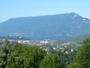 2
2 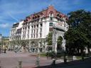 3
3  4
4 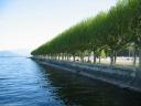 5
5 ![]() 6
6 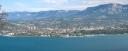
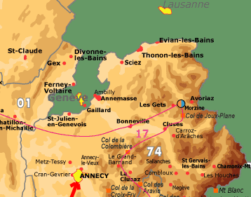
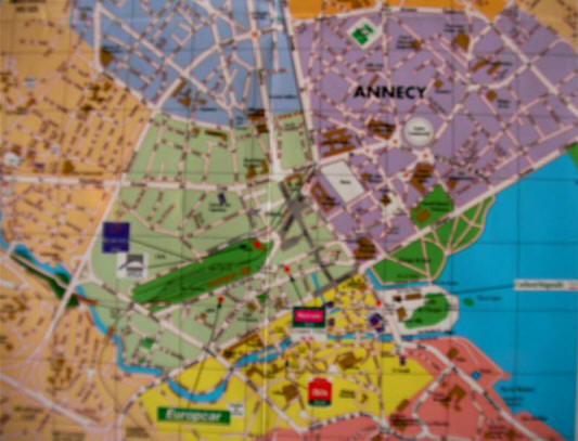
From the map left, you can see we
were heading north and east and it wasn't very mountainous. It only took us a half hour and we easily
found the hotel in Annecy with the GPS.
At
11:05 PM, we checked into the Ibis Annecy Centre Vieille Ville [12 rue de la Gare,
![]() +33-(0)4-50-45-4321].
+33-(0)4-50-45-4321].
Annecy (pop 52,000; area
135,000) (which is pronounced "ANTSY") is the warmest and most attractive town in the Alps.
It is situated at the northern tip of beautiful
Lac d'Annecy (Lake Annecy) and
surrounded by snow-covered mountains. Its medieval center is punctuated by
canals across the Thiou River [pronounced "TWO"], arcaded lanes and flower-studded bridges.
 Today Annecy is the capital of the
Haute-Savoie
(Upper Savoy)
region (emblem right.) The Savoy region
used to encompass this region as well as parts of Italy east across the Alps all the
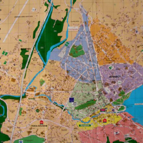
way to Torino (Turin) which was once its capital after it moved from Chamb�ry. The maps below show the area of the Old Town (yellow area) which abuts the lake
and the large beautiful park on the lake nearby.
Today Annecy is the capital of the
Haute-Savoie
(Upper Savoy)
region (emblem right.) The Savoy region
used to encompass this region as well as parts of Italy east across the Alps all the
way to Torino (Turin) which was once its capital after it moved from Chamb�ry. The maps below show the area of the Old Town (yellow area) which abuts the lake
and the large beautiful park on the lake nearby.
 At
11:15 we wanted to go out and explore a little
At
11:15 we wanted to go out and explore a little so we took a walk through the Old
Town and canal area. To our surprise, the streets were jammed with
people reveling like crazy. We found out we landed in the middle of an
annual big four day art festival in July called the Noctibules Festival of
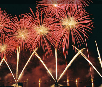
Performing Arts. It is
not the more famous Fete du Lac, an annual fireworks and water spectacle
(left) held annually in
the second week of August.
so we took a walk through the Old
Town and canal area. To our surprise, the streets were jammed with
people reveling like crazy. We found out we landed in the middle of an
annual big four day art festival in July called the Noctibules Festival of
Performing Arts. It is
not the more famous Fete du Lac, an annual fireworks and water spectacle
(left) held annually in
the second week of August.
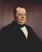
 That
celebration dates back to 1860, after Napoleon III helped
That
celebration dates back to 1860, after Napoleon III helped
 liberate
northern parts of Italy from
Austria and the Italians rewarded the French by giving them Nice and the western
half of
Savoy (Savoie: pronounced sav-WAH in French). It was the famous and
flamboyant
Count Camillo Benso di Cavour (left) (1810-61) who negotiated that deal for
Italy. His name and statues are all over Italy and I always wondered who
he was. Now I know.
liberate
northern parts of Italy from
Austria and the Italians rewarded the French by giving them Nice and the western
half of
Savoy (Savoie: pronounced sav-WAH in French). It was the famous and
flamboyant
Count Camillo Benso di Cavour (left) (1810-61) who negotiated that deal for
Italy. His name and statues are all over Italy and I always wondered who
he was. Now I know.
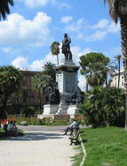
Above right: His statue in Piazza Cavour in Rome.
We squeezed our way through the packed streets and I caught this crepe girl happily plying her trade.
.JPG)
.JPG)
Every block seemed to have small amusements or music being played. We finally reached the canal and it was just beautiful with all the lights and flowers. We wondered what this red thing was far off in the middle of the Thiou canal.
.JPG)
As we got closer, we saw that it was a little island with an artificial palm tree and an artist performing some kind of pantomime in a tiny boat. Everything was painted red including the tree, the boat and the performer.
.JPG)
.JPG)
We didn't know what he/she was supposed to be doing but it was very colorful. Farther down there was a quartet of accordionists playing on this bridge while rocking on metal devices (below right.) This was all very enjoyable and we were having a good time.
.JPG)
.JPG)
We then came upon the beautiful Palaise de l'Isle in the center of the Thiou Canal. Its triangular form in the shape of a ship's bow
appears as
a ship anchored in the river whose waters it tirelessly divides.
.JPG) It was
originally built as the governor of Annecy's first residence in the 12th century.
It then served as
administrative center when the Count of Geneva settled in Annecy. Over the
years it became the seat of the
judiciary, the Mint, a prison, and then it was doomed to be demolished at the end of the
19th century. It was saved just in time thanks to its classification as a
Historical Monument. In front of it was a metal sphere sitting in the canal
with a scantily-clad girl dancing inside it to the music coming out of the Palaise.
It was
originally built as the governor of Annecy's first residence in the 12th century.
It then served as
administrative center when the Count of Geneva settled in Annecy. Over the
years it became the seat of the
judiciary, the Mint, a prison, and then it was doomed to be demolished at the end of the
19th century. It was saved just in time thanks to its classification as a
Historical Monument. In front of it was a metal sphere sitting in the canal
with a scantily-clad girl dancing inside it to the music coming out of the Palaise.
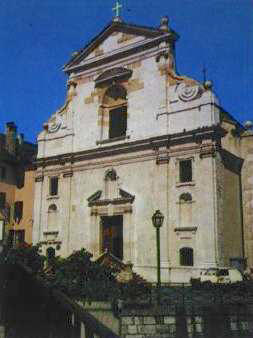
She's sitting on the top of it in the photo. We watched her until she was done and then we walked up and down checking out the various restaurants along the river walk. We continued following the crowd around the old town and went past the Church of St-Fran�ois-de-Sales (St. Francis de Sales.) (stock photo below left)
.JPG)
.JPG)
.JPG)
We also saw groups going around on motorized displays. By 11:40 we were getting tired and decided to finish up the evening by stopping at the Caf� Des Ducs (or Les Dieu Ducs) along the Canal and I had a 1664 beer and Marcia had a Creme de Menthe. After watching the river activity wind down, we walked back up the street and I had a citron (lemon) gelato which wasn't too bad.
.JPG)
.JPG)
We got back to the hotel at midnight and, after doing some photo stitching, I got to bed at 2 AM. This was an exciting and fun-filled day. The great benefits of travel.
Kenneth J. Hoffer, MD
Annecy, France
Sent 5-16-06
If you enjoyed these travels or wish to add comments on the places we visited
Please Leave Me a Message by clicking the spinning @ sign.
Click Here To: 
![]()

